The fit
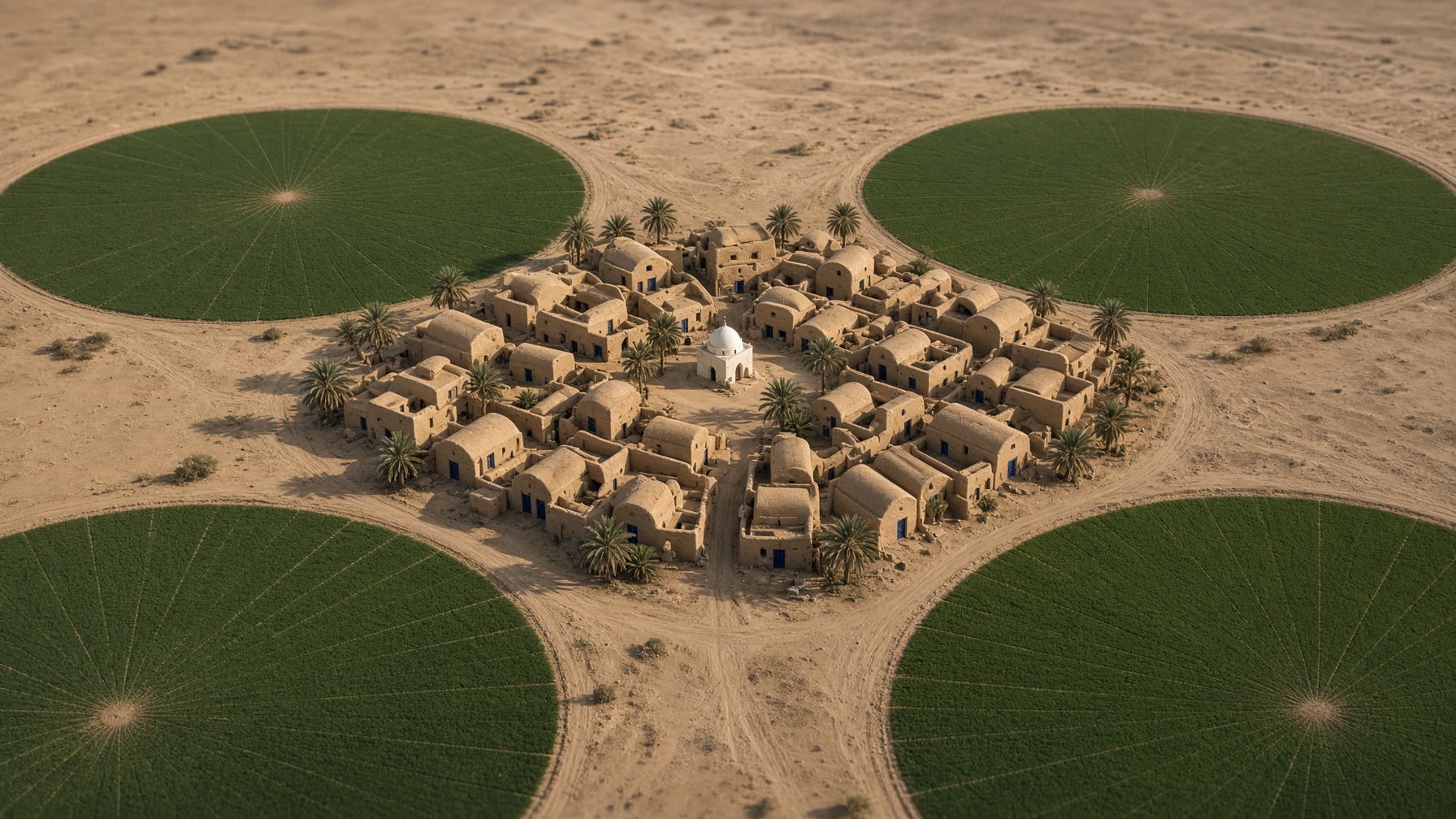
The nearest wheel passes 38 metres from the corner of the village. Across the agriculture areas this crossing repeats every eight pivots, in both directions.
Proposed settlement
Two hundred courtyard houses, between four pivots. The houses stand on the dry land the arms never reach, so no irrigated feddan is taken.
Settled population
1,000
Farm families
200
five to a house
Area
11.5 fed
220 × 220 m
Clear of the wheel
38 m
The same lattice, clipped to the ten polygons in the file. Green is the pivot field. Each dot is a village. The Nile is the solid blue line, from Lake Nasser to the Rosetta and Damietta mouths. The piped Tushka river is the dashed line: two branches leave the intake on Lake Nasser, one west across the desert and one north toward the Fayum.
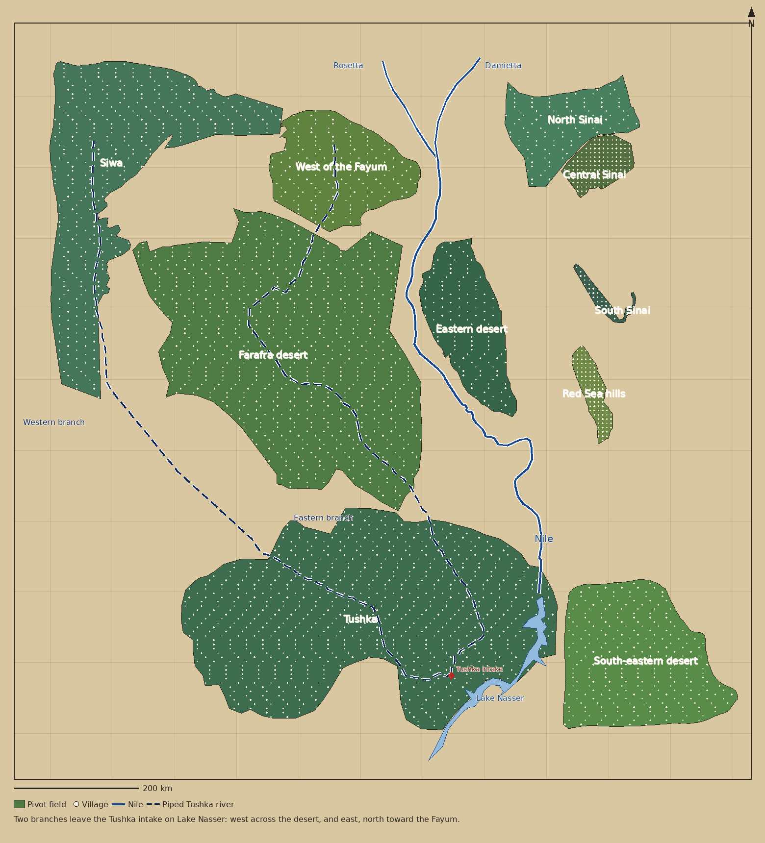
Illustrative organization inside the supplied outlines. Not a granted parcel. Algae farms in the same file are not tiled.
The last column is programme year 2036, the year on the control. The control opens at 2036 and runs from 2027 to 2076. The figure is that year’s pivots in production, shared across the ten areas in proportion to each area’s full pivot count. The Pivots column is the full layout, not that year.
Programme year
2036
| Area | Pivots | Villages | Pivots in 2036 |
|---|---|---|---|
| Farafra desert | 196,503 | 3,056 | 42,412 |
| Tushka | 207,668 | 3,219 | 44,822 |
| West of the Fayum | 42,304 | 652 | 9,131 |
| Siwa | 98,695 | 1,524 | 21,302 |
| South-eastern desert | 71,193 | 1,102 | 15,366 |
| Eastern desert | 34,468 | 533 | 7,439 |
| Red Sea hills | 6,248 | 97 | 1,349 |
| North Sinai | 27,506 | 422 | 5,937 |
| Central Sinai | 9,644 | 145 | 2,082 |
| South Sinai | 2,487 | 32 | 537 |
Each pivot is a circle of 400 metres, about 120 feddans. The centres are 840 metres apart, which leaves a 40-metre farm track between two circles. The village is a square of 220 metres on the crossing.
Layout map. North at the top. An illustrative module, not a granted site.
The nearest wheel passes 38 metres from the corner of the village. Across the agriculture areas this crossing repeats every eight pivots, in both directions.
Each house is a 10 by 14 metre plot: two vaulted rooms, a kitchen, and a court that takes the north air. Walls are shared. The lane is shaded. The mosque, the school, the clinic and the co-operative hall face one square.
| Use | m² | feddan |
|---|---|---|
| 200 courtyard houses | 28,000 | 6.7 |
| Shaded lanes | 8,400 | 2.0 |
| Square, mosque, school, clinic, co-op, market | 6,000 | 1.4 |
| Date court and windbreak | 6,000 | 1.4 |
| Village | 48,400 | 11.5 |